GWP offers high quality and accurate surveying, modelling & visualization services, as part of our full-service to the mineral extraction industries at site investigation, planning, design, and operations stages – and as a stand-alone service to landowners, building developers and architects.
The GWP surveying team has significant industry experience in many and varied site settings. We take the time to understand the clients’ needs and advise them on the optimum solution to form a true-to-scale record of existing features, resources, and boundaries.
Surveying Expertise

Data Capture
Using the latest GPS, UAV, Laser Scanners, and Total Stations for data capture, we stay at the forefront of surveying and capture data safely, quickly, and accurately.
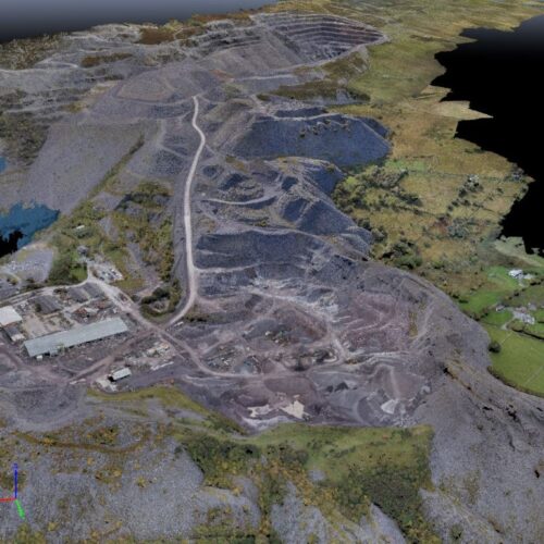
3D Modelling
GWP has extensive experience in processing data in 3D using LSS and CAD. The models can be interrogated to report volumes, areas, level differences, height banded cut/fill analysis and visibility analysis.
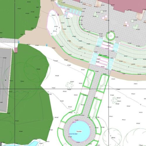
2D drawings
Our expert CAD drawing office produces 2D scaled drawings and plans for reporting and designing.
Baseline quarry survey operated by GWP Senior Surveyor, Dan Watkins
GWP Surveyors

Rhys Morgans
Associate Partner and Survey Manager

Dan Watkins
Senior Surveyor